To open any link in a new tab, preserving your position in the current article, just hold down the <CTRL> key on your keyboard before clicking the link or click using your mouse wheel.
SwiftMaps Development Use Only Work Around
- Jacob Oveson-Davis (Deactivated)
- Kristi Larson (Deactivated)
SwiftMaps Plugin has an issue in which users are getting a tile formatted message across the SwiftMaps workspace that obscures the image.
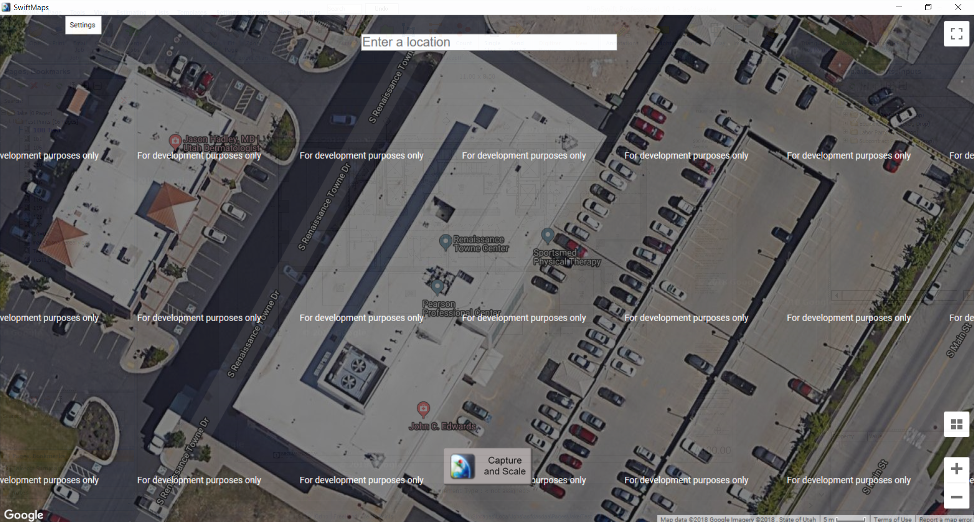
Although the Scale on the image will still work correctly, this makes it difficult to use the plugin because the image is darkened and the words may obscure the takeoff area.
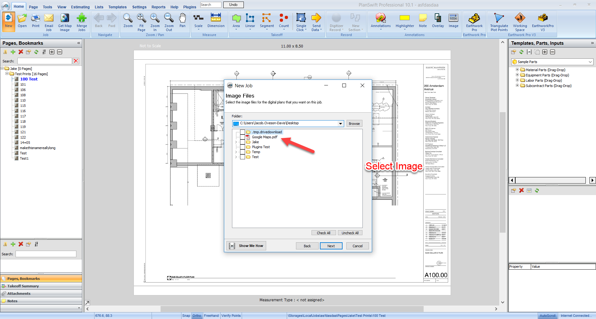
A temporary workaround to this issue is to use GoogleMaps to print the image to a PDF.
After the PDF has saved onto your computer, import the document into PlanSwift.
Next, use the scale added in the bottom right of the image to scale the image manually in the software.
Here is a step-by-step guide on the Workaround:
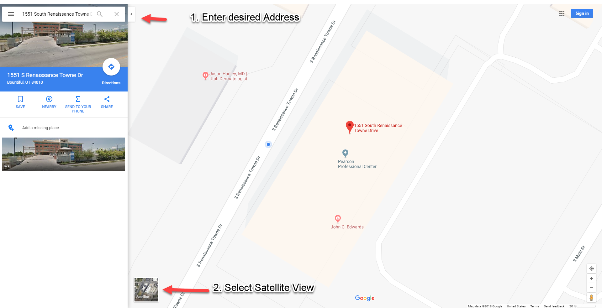
- Use Google Maps to locate the Address.
- Select Satellite View.
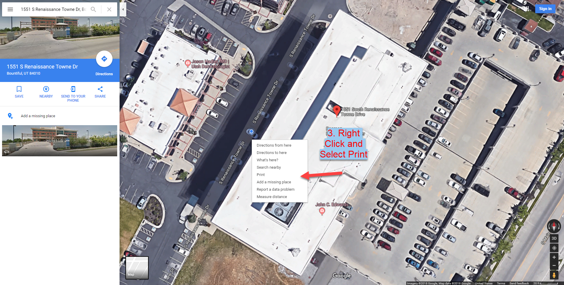
- Orient the Image so you can see the object fully.
- Print the Object Using a PDF Writer (or capture Screenshot).
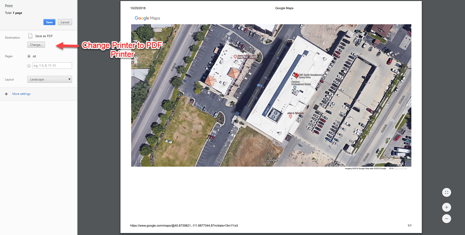
- Import image into PlanSwift.
6. Manually Set Scale using Scale in the bottom right of the Image.

Google Maps has given you the scale based on location, so if there are any issues with the scale it will be on Google's end.
Related content
Copyright 2023 ConstructConnect